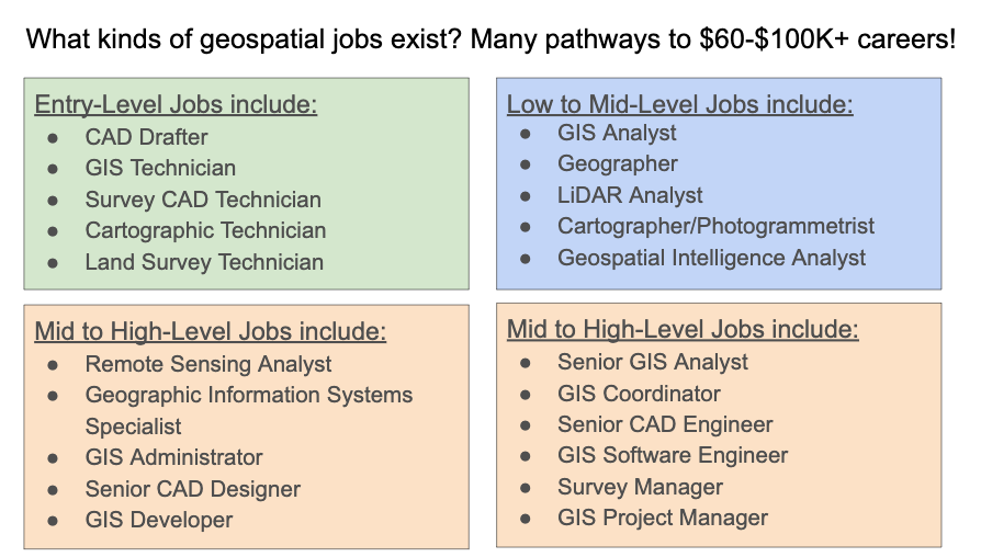
Assist scientists in mapping environments using satellite data for natural resources management, urban planning, and homeland security. Many other technology careers incorporate these skills as part of the job. Demand for advanced geospatial skills is very high, thus career opportunities and salaries increase significantly with experience and further education.
A Typical Day
- Collect geospatial data, using technologies such as aerial photography, light and radio wave detection systems, digital satellites, or thermal energy systems.
- Verify integrity and accuracy of data contained in remote sensing image analysis systems.
- Integrate remotely sensed data with other geospatial data.
- Consult with remote sensing scientists, surveyors, cartographers, or engineers to determine project needs.
Recommended Credentials
Training Certificate or Associate Degree
Education & Training
Regional employers often hire graduates of these programs.
Northwest Lower Michigan
Northwestern Michigan College
- Engineering Technology, AAS in Marine Technology
- Offer Remote Sensing (WIS 300) and GIS Classes
Elsewhere in Michigan
Northern Michigan University
- GIS Program, Certificate, Bachelor of Science Degree with several minor specialization options
- NMU integrates the geomatics courses with computer science, Fisheries and Wildlife Biology, Environmental Science, and other programs offered at NMU.
Explore This Career
Try it before you buy it!
- Watch the STEM Careers Video on Geographic Information Systems
- Take a GIS class at your high school
The Local Advantage Learning Pathway
Pathway 1
- GIS Program in Sutton's Bay, Elk Rapids, TC West High Schools
- Northwest Education Services (formerly TBAISD) Career Tech Center, Robotics & Automation
Pathway 2
Articulation agreements with Northwest Education Services (formerly TBAISD) CTC:
Northwestern Michigan College Engineering Technology
- AAS in Marine Technology
- Offer Remote Sensing and GIS classes
Pathway 3
Northwestern Michigan College, Engineering Technology: BS in Marine Technology (includes application of GIS skills in water environments)
TIP
Contact one of these companies and ask for an informational interview, to see if you can job shadow, or to find out if they hire interns.
Sample Job Titles...
- Compiler
- Digital Cartographic Technician
- Geospatial Extractor
- Meteorologist Liaison
Hear It From The Pros
10-Year Job Growth Projections
Employed Regionally
Wage Range & Median Michigan
Annual Hires Regionally
Other Regional Career Resources
Sample Career Pathways


